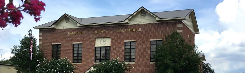
Before Randolph County had the bridges it does today, an important part of transportation and connection to neighboring communities was via fords and ferries along the Tallapoosa River and its tributaries.
The proprietors of the early ferries charged a fare to the travelers who crossed the river first by wagon, then with vehicles. Gradually bridges were built, putting the ferrymen out of business, but some of the last remaining ferries became part of a county’s highway department. These ferries then operated at no charge to drivers, and the operators were employees of the county (later state) highway department.
The exact locations and operators of some of Randolph County’s ferries have been lost to time, but here are some we have learned about.
BURROW’S/CRAVER’S/HWY. 48 FERRY
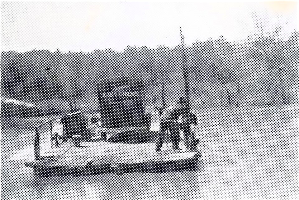
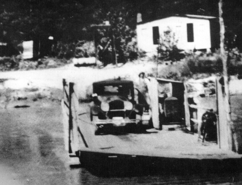
The ferry more people are familiar with today is the one that operated the longest. At one time it was Burrow’s Ferry, then became Craver’s Ferry and is also referred to as the Highway 48 Ferry. Burrow’s Ferry is seen on a 1911 map, east of the Ofelia community, near where the two rivers join.
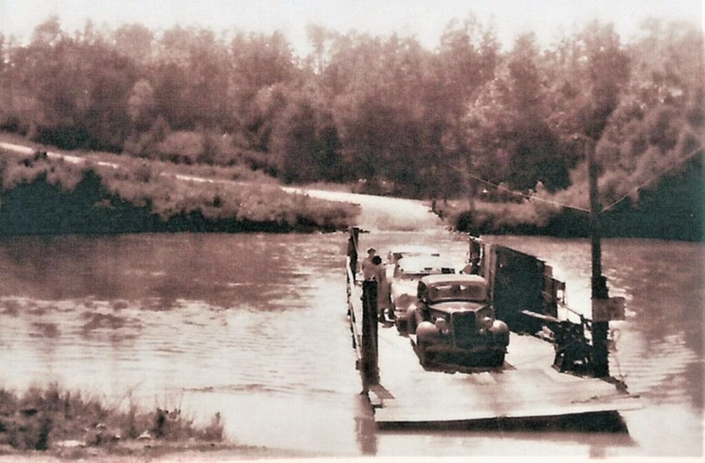
Cass Radney worked the ferry in 1932 when he passed away in his sleep in the ferryman’s house. Shortly thereafter, it was purchased by Marshall Craver.
Life on the river could be dangerous. In 1936, not only was Mr. Craver’s ferry boat hung up about 100 yards downstream by floodwaters, but his house was also lodged there.
The following year, Rahrer’s Machine Shop of Anniston manufactured a new ferry for Craver that could accommodate six cars and decrease wait time for motorists.
Randolph County Commission purchased Craver’s Ferry from Mr. Craver in 1939 and announced that starting in January 1940, it would be free to ride as part of the county’s highway department. Eck Hanson and Speck Bailey were low bidders to run Craver’s Ferry for the county for a year. Other ferrymen over the years included Newman White, Calvin Mason and Russell Dewberry.
A 1942 flood sank the county’s ferry. Because it was tied for the night, it couldn’t rise with the river, which rose 6 feet in two hours! Traffic had to be detoured for a time.
Over the course of 40 years, there were three fatalities on the ferry, two individuals and one mule.
In 1902, The Wedowee Star had this account: “A Negro woman, the wife of Bud Robertson, was drowned at Burrow’s Ferry on last Tuesday evening. It seemed that she was on her way from Wedowee, where she had been to see her husband, who is in jail, and when she reached the ferry, drove onto the flat, and the mule got frightened and backed off into the river, and the woman and mule were both drowned. Her body was not found until Wednesday.”
When Thurman Coker, 33, of Ashland drowned at the ferry in December 1942, The Ashland Progress reported: “While crossing the river, the car began to move on the ferry, but Mr. Coker hadn’t realized it until the ferryman called his attention to it. Seated in his car, he attempted to apply the brakes and evidently became frightened and threw it in reverse, backing off into the river. The car was gotten out the next day with identifying papers inside. He was found the following day.” Mr. Coker had worked as a coach in Clay County.
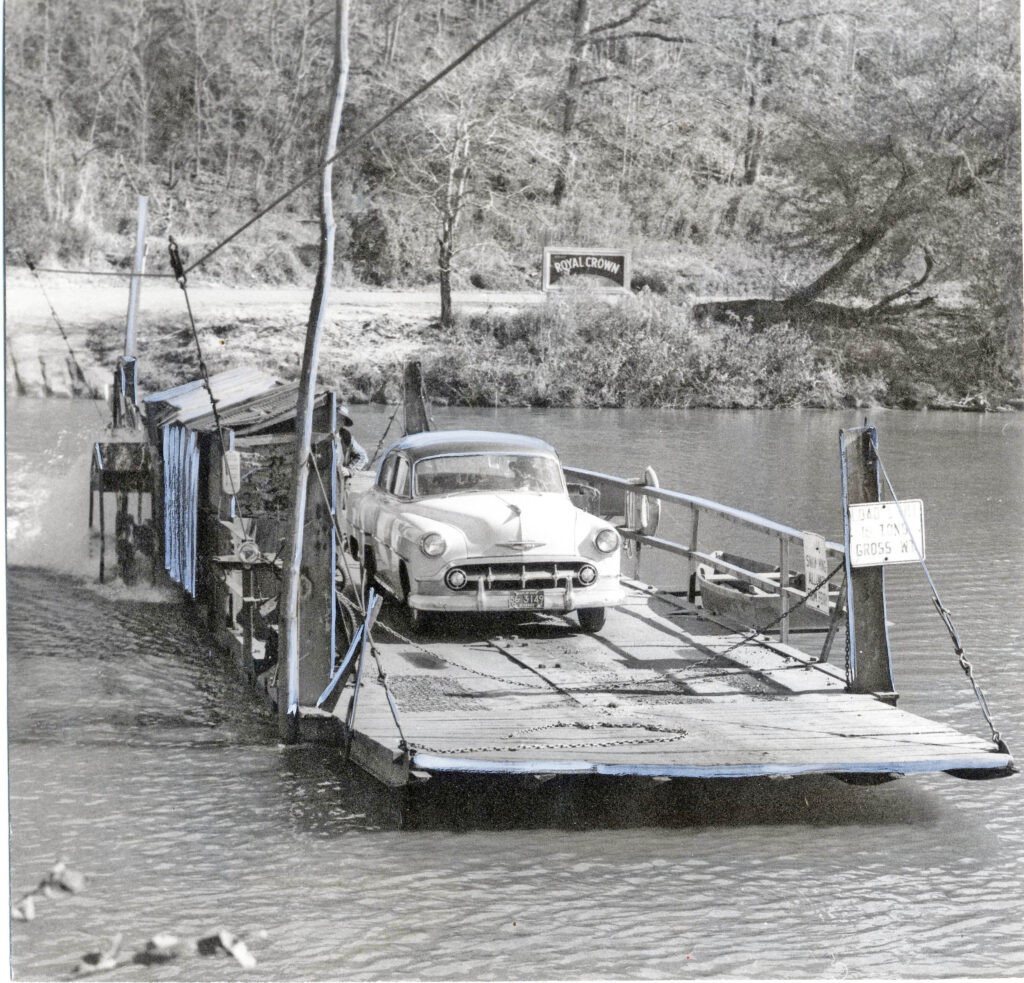
The following year, the Alabama Department of Transportation (ALDOT) took over operation of the ferry. According to ALDOT’S pay scale, ferrymen could make $198-265 per month.
The last state-employed proprietors of the ferry were members of the Pool family, Luther and sons Ernest and C.L. They escorted between 150 to 250 vehicles across the river every day, operating the ferry round the clock.

(Many from this area may also remember Bibby’s Ferry, located in the Frogeye community outside of Wadley. It also started as a private ferry, but became a part of the Chambers County Highway Department. The ferry boat is now displayed next to the Chambers County Museum and former LaFayette Depot on First Avenue Southwest in LaFayette.)
In a 1950 campaign advertisement, state representative candidate Jesse Hearn of Roanoke stated, “At ferries, passenger buses are supposed to unload all passengers before driving on the ferry. This is not done by the school bus crossing our ferry. This operator of the ferry says it is more safe not to unload school buses, as the children would be all over the ferry. In this, I suppose he is correct … I say school buses have no business on a ferry at all. That ferry must be replaced by a bridge.” Many people in the area still remember their school bus crossing the river via ferry either going to school or as a high school athlete headed to an away game.
Alabama Gov. “Big Jim” Folsom first promised a new bridge for the crossing in 1947 and finally confirmed the announcement in 1956.
The Overton Bridge was dedicated in April 1958 with Folsom present at the ceremony. The bridge cost $205,000 and was named in honor of the late two-term State Sen. John Overton. Although it was not part of newspaper accounts, many citizens who attended the dedication passed along stories of “Big Jim” being intoxicated at the event.
GOING DOWN THE LITTLE RIVER
Burnett’s Ferry on the Little River, west of Hawk, is on maps dating from 1837 and 1856.
McBurnett’s Ferry was on the Little River. It can be seen further down near the center of the county on a 1911 map.
A 1901 article mentions a new bridge at Savage’s Ferry on the Little Tallapoosa near the fork of the rivers, but we were unable to find Savage’s Ferry on a map. From this description, it’s possible it’s the same as Burrow’s Ferry.
GOING DOWN THE BIG RIVER
East Ferry can be seen on a 1911 map and was located on the Big River, east of Liberty Church of Christ.
Boggs’ Ferry crossed the Big River. A 1902 account of a trip from Napoleon to Wesley’s Chapel states, “We crossed the Little River at the upper iron bridge and Big River at Boggs’ Ferry.” We were unable to find Boggs’ Ferry on a map. It’s possible it could have been the same as East Ferry or Butler’s Ferry at different times in history.
Butler’s Ferry was south of East Ferry on the Big River and may be seen on a 1909 map. It was north of Mad Indian Creek.
SOUTH OF 48
A ferry was operated at the location of Blake’s Ferry since at least 1832. It would have been from about County Road 804 on the Randolph County side to around Flat Rock Park and New Harmony Church on the Clay County side.
Randolph County’s original county seat was located at Triplett’s Ferry. Hedgeman Triplett sold the ferry to Richard Young when the county seat was moved to Wedowee. When Mr. Young died in 1844, Thomas Blake bought it, and his son, John Blake, owned it until his death.
In 1930, Thomas Cleveland Harris and James R. Wilson, both of Clay County, built a new flat for crossing at Blake’s Ferry. It must have been short lived because in 1934, the two men built another new ferryboat. The boat was replaced again in 1937.
Going south, next came Wellborn’s Ferry, located northeast of New Hope West Church. It was referenced in a newspaper story about a drowning in 1905 and can be seen on a map dated 1911.
T.N. “Newt” Browning established Browning’s Ferry and owned a great amount of land near New Hope West in the Cragford area. This ferry, north of Malone, operated around the turn of the last century.
The Malone Ferry was established by J. Thomas Wafer, a county commissioner, in the mid-1800s. It was also referred to as Woods Ferry. It was located near where Cornhouse Creek meets the river.
According to The Wedowee Star, the contracts for bridges at Malone Ferry, Island and Foster’s Ford were let in 1908. The low bidder was Roanoke Bridge Company of Roanoke, Va., with a bid of $20,100. The ferry was discontinued when this bridge was built.
Below Malone was Hester’s Ferry, located in the Corinth community near the fish camp of the Heflin family, widely known in Alabama politics. This ferry was operated by Jeremiah Hester. It also closed when the bridge at Malone was built in 1908.
Now a ghost town, Louina had a ferry until a river bridge was built in 1904, just as Louina – once the largest town in the county – was dwindling. The first lots were sold on the west side of the river in the newly created town of Wadley in 1907.
The Wadley Ferry was reinstated for a time in 1920 after the bridge washed out in a flood and had to be rebuilt.
(Sources: Newspapers The Roanoke Leader, The Randolph Press, The Ashland Progress, The Lineville Headlight, The Birmingham News, The Wedowee Star and The Anniston Star, University of Alabama Cartography, and Forgotten Randolph County and Hills of Clay Facebook pages.)